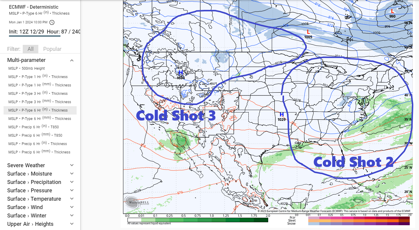
Newest Updates will be at the bottom
1/02/24 2PM Update:


For the next images they show the probability of 1, 3, 6 and 12 inches in %.


For the next images they show all of the possible locations of the low pressure center.


1/02/24 8PM update:
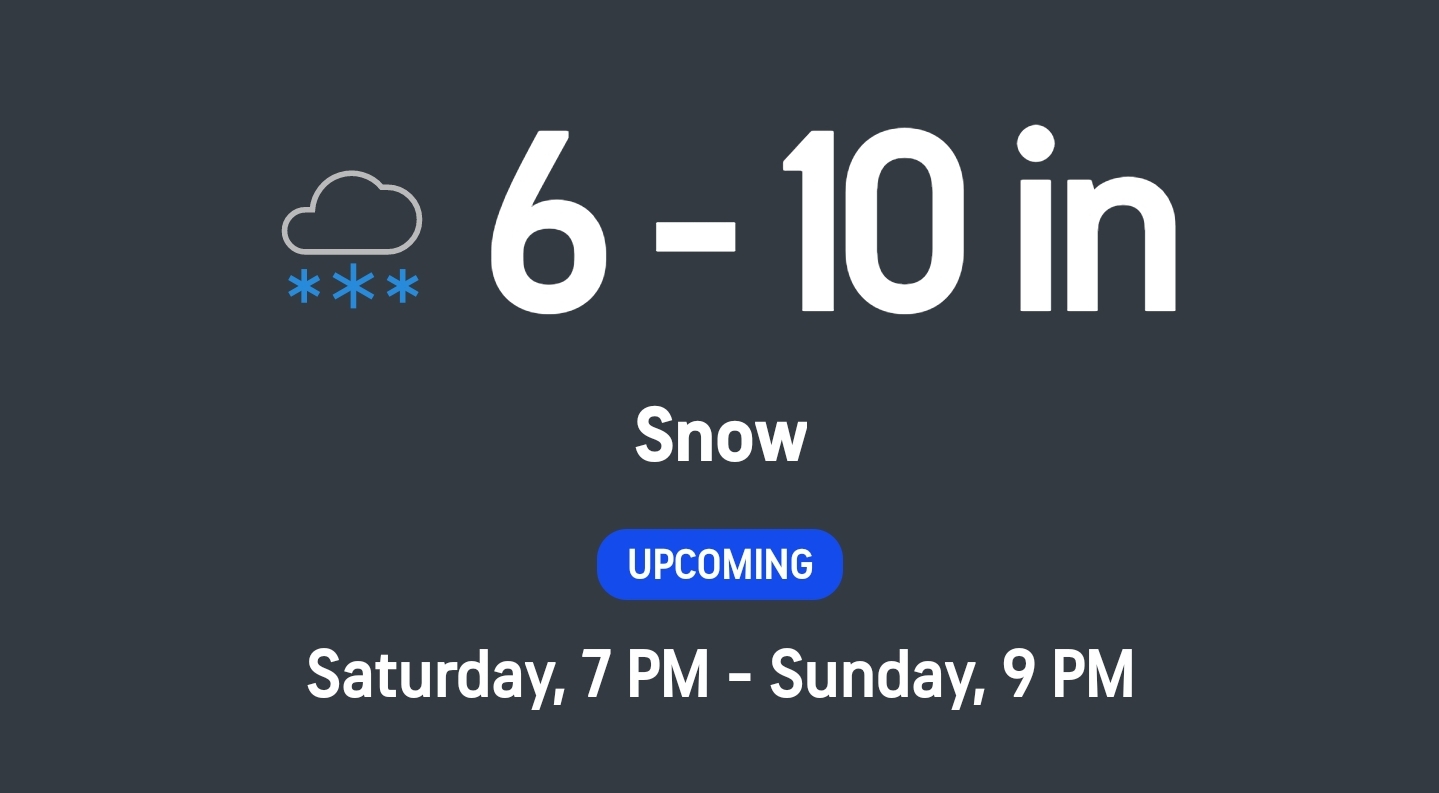
According to Accuweather we could see 4 – 8 inches. I personally think that is a bit under the amount we could see I think it is more like 6 – 10 inches.

As you see 2-4 compared to 8-12, 8-12 has a bit higher chance than the lower 2 – 4 inches. That is why I personally think that is a bit under the amount we could see.


1/03/24 11am update:


The next image is the Canadian ensemble.


Now for the Canadian ensemble.


1/03/24 2PM Update:


1/03/24 8PM update:
I still think the snow totals will be more like 6 -10 inches all the models say 8 inches or more. Even Accuweather and The Weather channel are hinting at more with The Weather Channel saying 5 – 8 inches on Saturday night and another 1 – 3 on Sunday.


1/04/24 1 PM Update:


1/04/24. 4PM Update
…WINTER STORM WATCH IN EFFECT FROM SATURDAY AFTERNOON THROUGH SUNDAY EVENING…
* WHAT…Heavy snow possible. Total snow accumulations of 5 to 10 inches possible. Winds could gust as high as 35 mph.
* WHERE…The Capital Region, Saratoga Springs and Glens Falls areas, Mohawk and Schoharie Valleys, eastern Catskills, mid Hudson Valley, and the Taconics of eastern New York, southern Vermont, the Berkshires of western Massachusetts and northwest Connecticut.
* WHEN…From Saturday afternoon through Sunday evening.* IMPACTS…Travel could be very difficult due to snow covered roadways and reduced visibility.
* ADDITIONAL DETAILS…Snowfall rates may be close to one inch per hour at times for late Saturday night into early Sunday morning.PRECAUTIONARY/PREPAREDNESS ACTIONS…Monitor the latest forecasts for updates on this situation.
The next three images are from The Weather Channel.